")
IMAGE
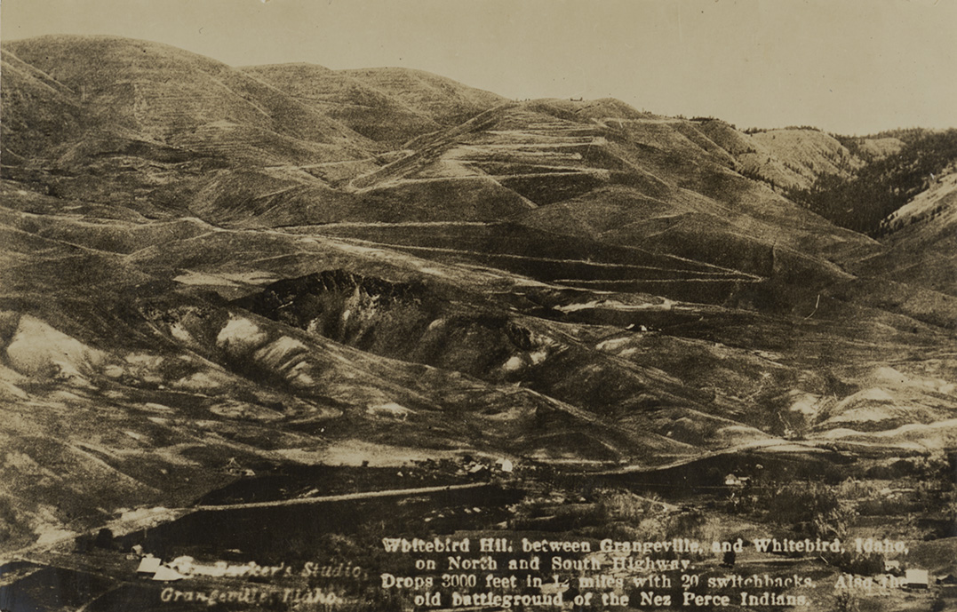
Whitebird Hill between Grangeville and Whitebird, Idaho Item Info
- Title:
- Whitebird Hill between Grangeville and Whitebird, Idaho
- Creator:
- G.V. Barker
- Date Created:
- 1913
- Description:
- Postcard is of a winding road near White bird, Idaho. | White bird Hill between Grangeville and White bird, Idaho on North and South Highway. Drops 3000 feet in 12 miles with 20 switchbacks. Also the old battleground of the Nez Perce Indians.
- Subjects:
- highways mountains hills roads trees buildings photographic postcards
- Location:
- Whitebird, Idaho
- Latitude:
- 45.756326
- Longitude:
- -116.300683
- Source:
- PG 9, Postcard Collection, University of Idaho Library Special Collections and Archives, https://www.lib.uidaho.edu/special-collections/
- Source Identifier:
- pg_9_327_01
- Type:
- Image;StillImage
- Format:
- image/jpeg
- Language:
- eng
Source
- Preferred Citation:
- "Whitebird Hill between Grangeville and Whitebird, Idaho", Practice Run, Center for Digital Inquiry and Learning (CDIL)
- Reference Link:
- https://abigayle88.github.io/practice-run/items/nwpostcards1762.html
Rights
- Rights:
- Material determined to be in Public Domain based on date of publication. Material made available by the University of Idaho Library. For more information, please contact University of Idaho Library Special Collections and Archives Department at libspec@uidaho.edu.
- Standardized Rights:
- https://creativecommons.org/publicdomain/mark/1.0/